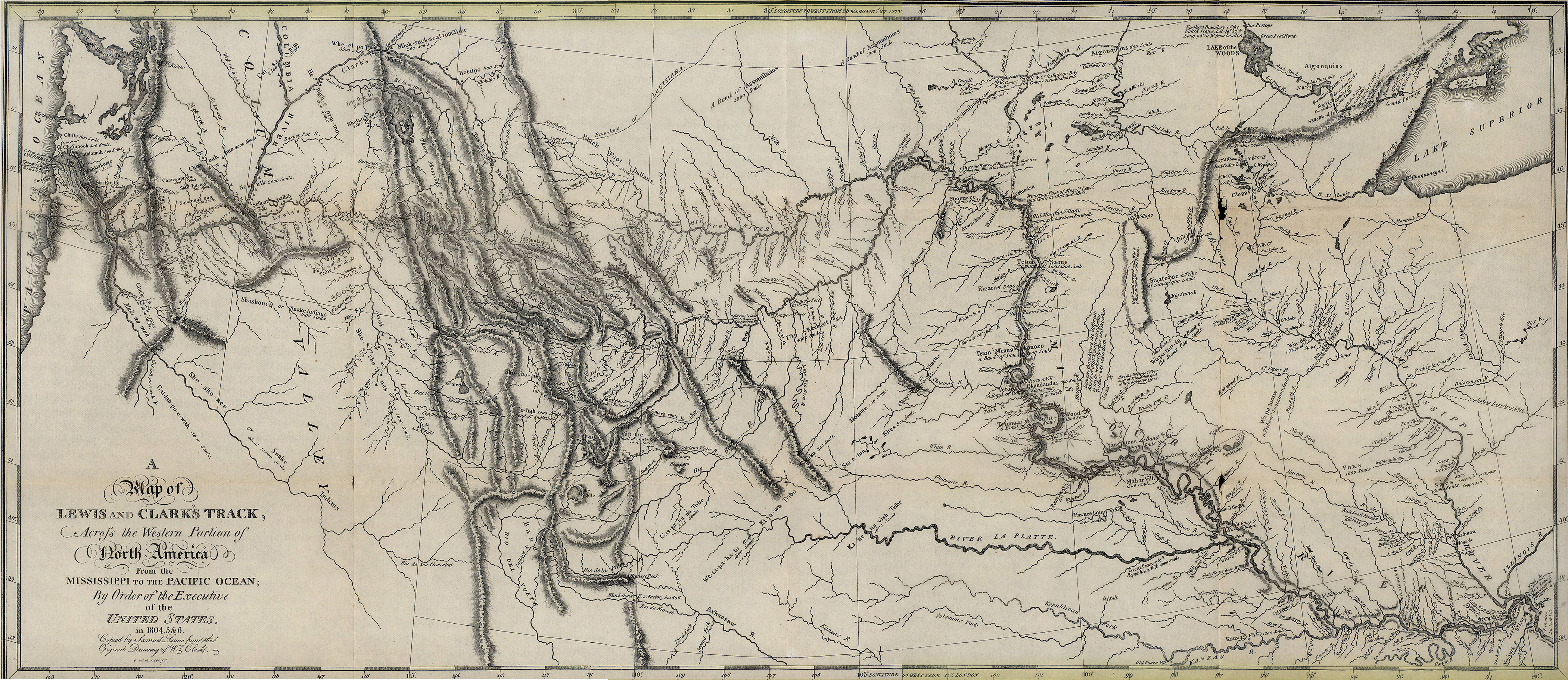
![This 1806 map was reproduced from William Clark’s original map that traced the expedition’s journey across the Louisiana Purchase to the Pacific Ocean. [State Historical Society of Missouri Map Collection, 800.4 C549m 1804-1806]](/sites/default/files/styles/article_header_image/public/2023-01/1.%20Lewis%20and%20Clark.jpg?h=48be2a7f&itok=wWe64dFT "This 1806 map was reproduced from William Clark’s original map that traced the expedition’s journey across the Louisiana Purchase to the Pacific Ocean. [State Historical Society of Missouri Map Collection, 800.4 C549m 1804-1806]")
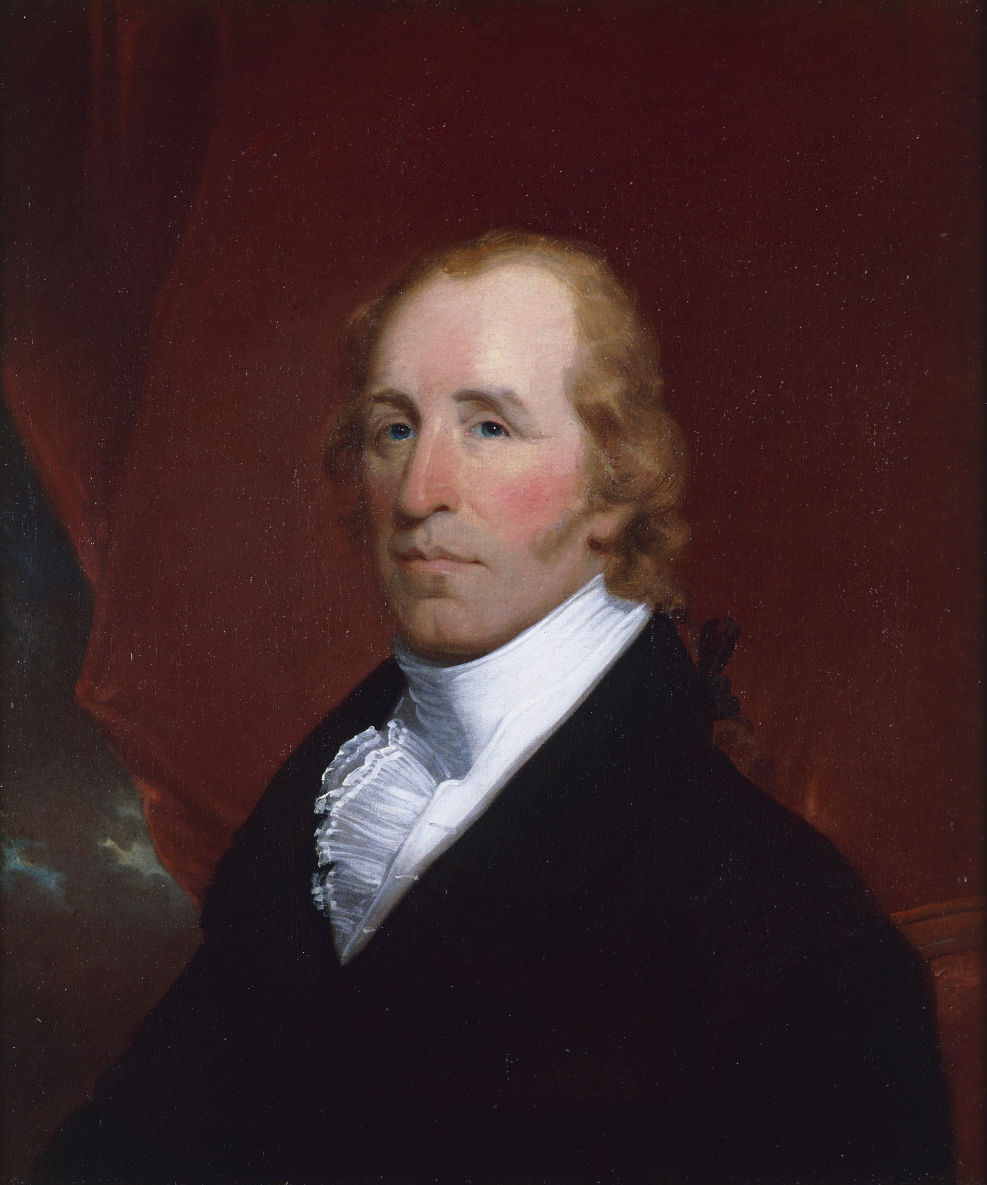
![Meriwether Lewis, reproduction of painting by C. W. Peale, c. 1807. [Library of Congress, Prints and Photographs Division, LC-USZ62-20214]](/sites/default/files/styles/article_header_image/public/2023-01/2.%20Lewis%20and%20Clark.jpg?itok=NNHEEm3a "Meriwether Lewis, reproduction of painting by C. W. Peale, c. 1807. [Library of Congress, Prints and Photographs Division, LC-USZ62-20214]")
![William Clark, portrait by John Wesley Jarvis, c. 1810. [Missouri Historical Society, St. Louis, 1921-055-0001]](/sites/default/files/styles/article_header_image/public/2023-01/3.%20Lewis%20and%20Clark.jpg?itok=zk1u2O7I "William Clark, portrait by John Wesley Jarvis, c. 1810. [Missouri Historical Society, St. Louis, 1921-055-0001]")
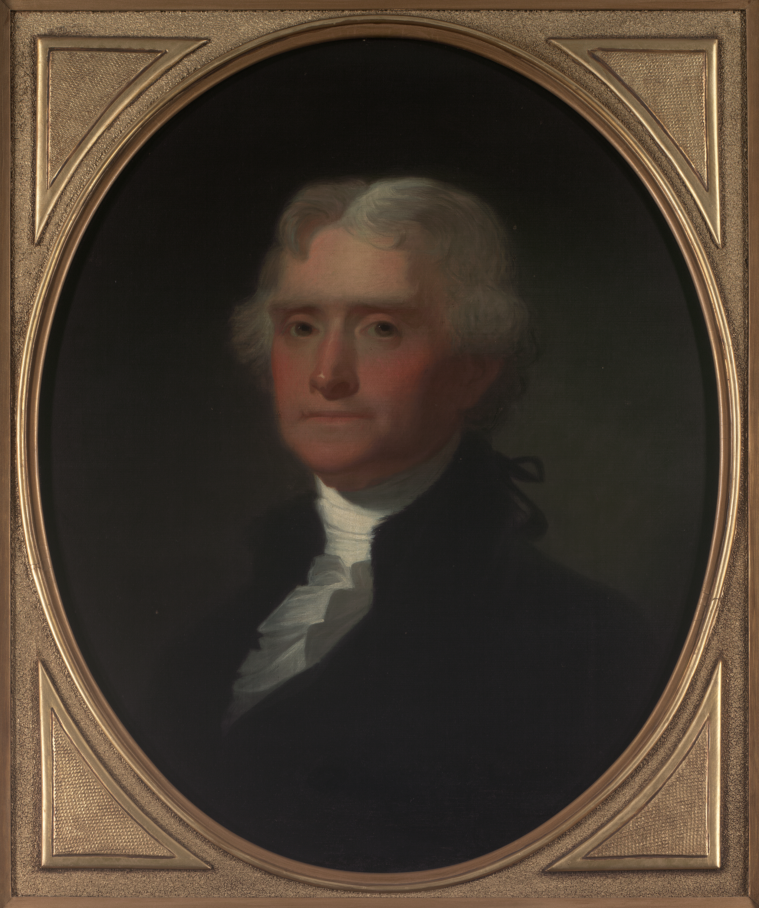
![Thomas Jefferson, portrait by George Caleb Bingham. [State Historical Society of Missouri Art Collection, 1949.0001]](/sites/default/files/styles/article_header_image/public/2023-01/4.%20Lewis%20and%20Clark.jpg?itok=b0emmgah "Thomas Jefferson, portrait by George Caleb Bingham. [State Historical Society of Missouri Art Collection, 1949.0001]")
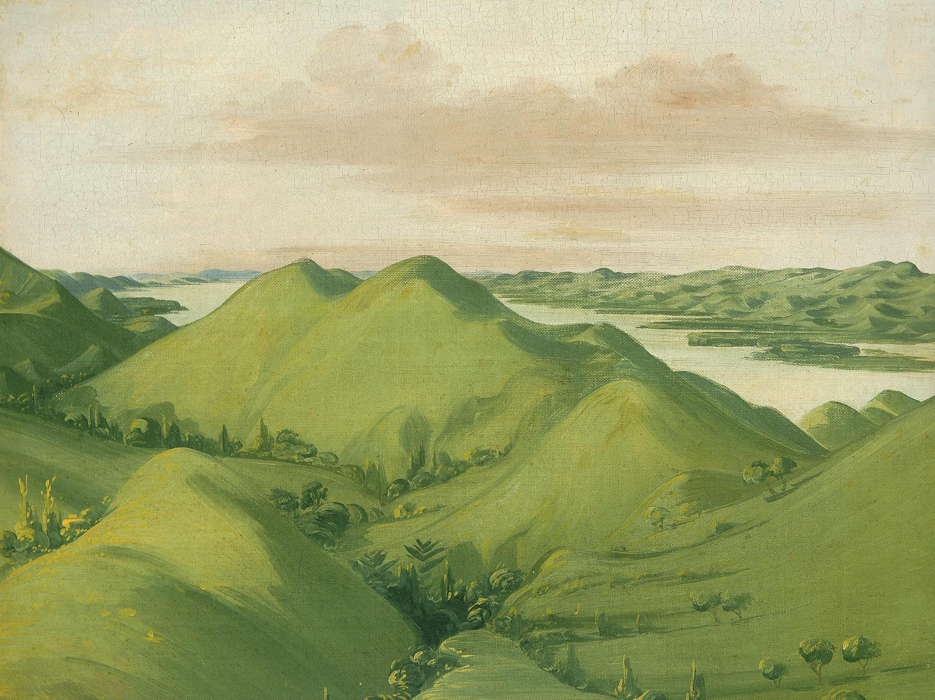
![Beautiful Grassy Bluffs, 110 Miles above St. Louis, by George Catlin. The Corps of Discovery encountered a wide variety of natural landscapes on their trek to the Pacific coast, including rolling prairies, vast rivers, towering limestone bluffs, and rugged mountain ranges. [Smithsonian American Art Museum, SAAM-1985.66.373_1]](/sites/default/files/styles/article_header_image/public/2023-01/5.%20Lewis%20and%20Clark.jpg?itok=KCzM6uZ- "Beautiful Grassy Bluffs, 110 Miles above St. Louis, by George Catlin. The Corps of Discovery encountered a wide variety of natural landscapes on their trek to the Pacific coast, including rolling prairies, vast rivers, towering limestone bluffs, and rugged mountain ranges. [Smithsonian American Art Museum, SAAM-1985.66.373_1]")
![Hidatsa Village, Earth-covered Lodges, on the Knife River, 1810 Miles above St. Louis, by George Catlin. The Hidatsa were among the many Native American tribes that the corps made contact with during the expedition. [Smithsonian American Art Museum, SAAM-1985.66.383_1]](/sites/default/files/styles/article_header_image/public/2023-01/6.%20Lewis%20and%20Clark.jpg?itok=Zouf1SPO "Hidatsa Village, Earth-covered Lodges, on the Knife River, 1810 Miles above St. Louis, by George Catlin. The Hidatsa were among the many Native American tribes that the corps made contact with during the expedition. [Smithsonian American Art Museum, SAAM-1985.66.383_1]")
![Magnificent Clay Bluffs, 1800 Miles above St. Louis, by George Catlin. The Corps of Discovery likely saw these bluffs toward the end of their journey up the Missouri River. [Smithsonian American Art Museum, SAAM-1985.66.370_1]](/sites/default/files/styles/article_header_image/public/2023-01/7.%20Lewis%20and%20Clark.jpg?itok=L3HMbaFn "Magnificent Clay Bluffs, 1800 Miles above St. Louis, by George Catlin. The Corps of Discovery likely saw these bluffs toward the end of their journey up the Missouri River. [Smithsonian American Art Museum, SAAM-1985.66.370_1]")
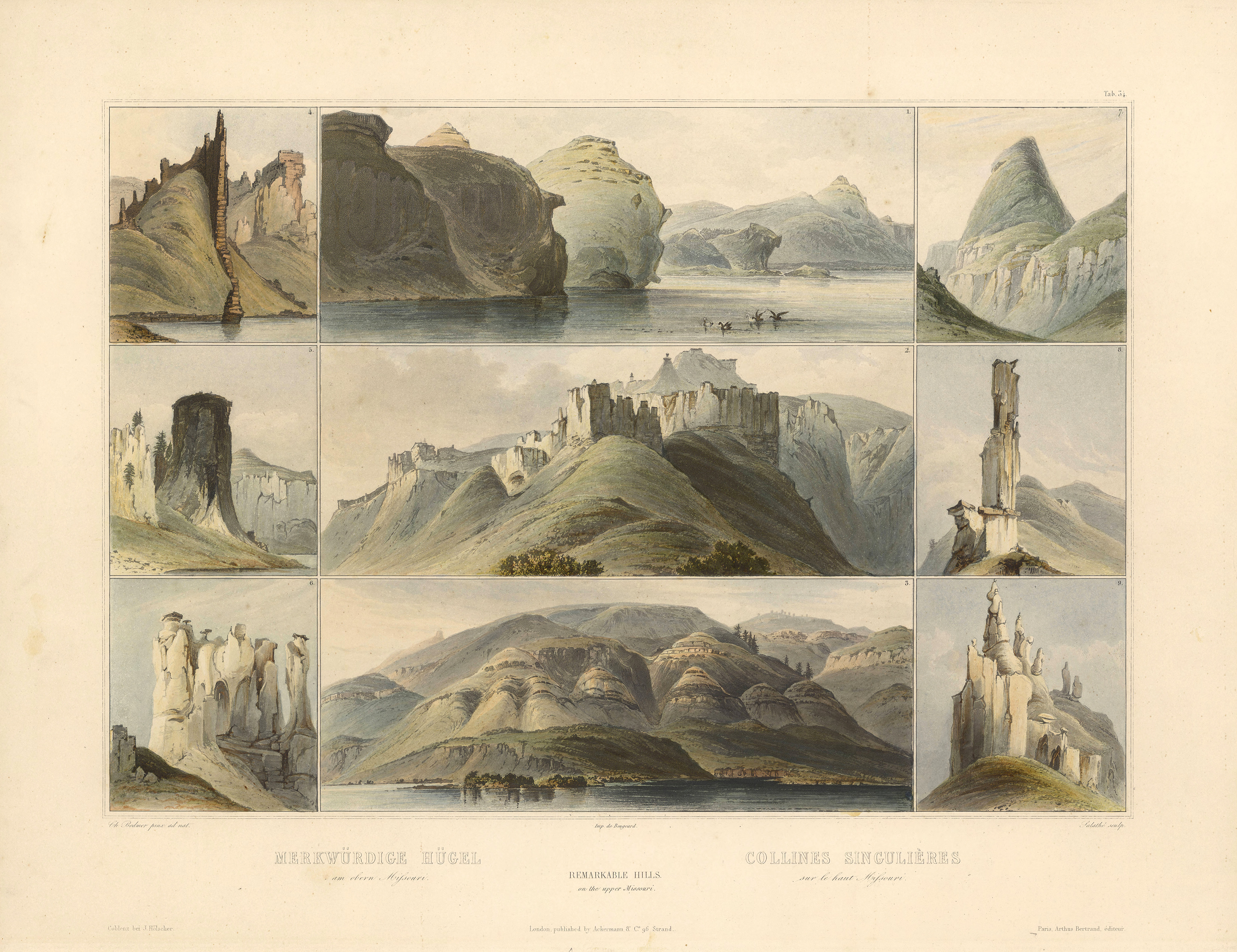
![Karl Bodmer’s depictions of formations along the upper Missouri River, created during the artist’s western journey with the explorer Prince Maximilian of Wied from 1832 to 1834. [State Historical Society of Missouri Art Collection, 1958.0034c1]](/sites/default/files/styles/article_header_image/public/2023-01/8.%20Lewis%20and%20Clark.jpg?itok=ZcvnSkij "Karl Bodmer’s depictions of formations along the upper Missouri River, created during the artist’s western journey with the explorer Prince Maximilian of Wied from 1832 to 1834. [State Historical Society of Missouri Art Collection, 1958.0034c1]")
![Charged with documenting the flora and fauna of the West, Lewis and Clark encountered animals such as the grizzly bear, depicted here in an artwork by John Woodhouse Audubon. [State Historical Society of Missouri Art Collection, 1978.0122]](/sites/default/files/styles/article_header_image/public/2023-01/9.%20Lewis%20and%20Clark.jpg?itok=WShpbKQ2 "Charged with documenting the flora and fauna of the West, Lewis and Clark encountered animals such as the grizzly bear, depicted here in an artwork by John Woodhouse Audubon. [State Historical Society of Missouri Art Collection, 1978.0122]")
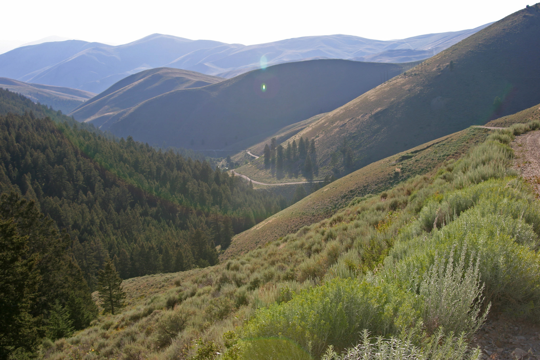
![Lemhi Pass in what is now Idaho. The expedition crossed the Continental Divide here. [US Bureau of Land Management, photo by Antonia Hedrick]](/sites/default/files/styles/article_header_image/public/2023-01/10.%20Lewis%20and%20Clark.jpg?itok=lDAw2L-R "Lemhi Pass in what is now Idaho. The expedition crossed the Continental Divide here. [US Bureau of Land Management, photo by Antonia Hedrick]")
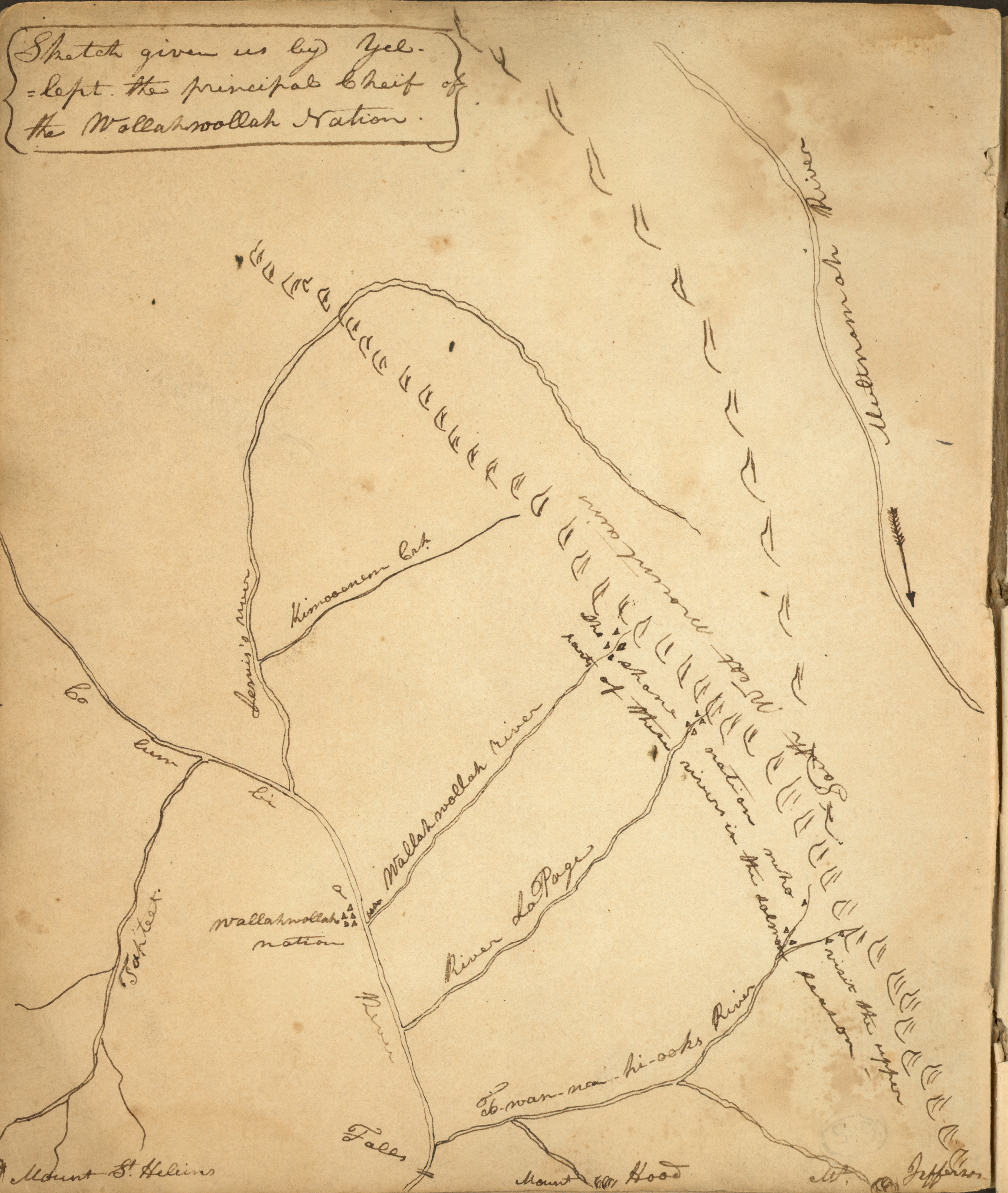
![A map in the back of Meriwether Lewis’s astronomy notebook, sketched by Chief Yellept of the Walla Walla nation, whose village was on the Columbia River. [State Historical Society of Missouri, Meriwether Lewis Astronomy Notebook (1805), C1073]](/sites/default/files/styles/article_header_image/public/2023-01/11.%20Lewis%20and%20Clark.jpg?itok=Xn9-ils2 "A map in the back of Meriwether Lewis’s astronomy notebook, sketched by Chief Yellept of the Walla Walla nation, whose village was on the Columbia River. [State Historical Society of Missouri, Meriwether Lewis Astronomy Notebook (1805), C1073]")
Between May 1804 and September 1806, the Lewis and Clark expedition made its way up the Missouri River, across the continental divide to the Pacific Ocean, and back to St. Louis. Remarkably, during its often perilous eight-thousand-mile journey the small military party commanded by Captains Meriwether Lewis and William Clark suffered only a single casualty, and it was likely the result of a ruptured appendix. While their overland trek was replete with incidents involving extreme weather, treacherous terrain, raging rapids, and menacing grizzlies, those adventurous episodes constitute only a small piece of the expedition story. Lewis and Clark were explorers in pursuit of new discoveries, agents of empire, and harbingers of conquest. The geographic, scientific, and ethnographic information they collected added to the existing store of knowledge and roused dreams of US territorial expansion that forever altered the American West. Some of the expedition’s byproducts proved excessively costly for the Native Americans who had allowed the Corps of Discovery to pass through their neighborhoods largely without incident. Successive waves of post-expedition settlers confiscated tribal homelands, attempted to disrupt Native lifestyles and cultures, and reconfigured the western landscape.
The future state of Missouri and its inhabitants loom large in the stories of Lewis and Clark’s voyage of discovery and the American nation’s advance westward. The territory then known as Upper Louisiana was the expedition’s point of departure, the locale where the exploring party’s intrepid crew members initially tested their survival skills and learned to navigate western waters; the place where, following their return from the Pacific, Lewis and Clark assumed responsibility for administering the recently acquired Louisiana Territory; and the gateway that served as an outfitting and supply post for generations of westering travelers, traders, and settlers.
Thomas Jefferson, who had long contemplated the benefits of exploration and discovery, chose Captain Lewis, then serving as his private secretary, to lead a military contingent westward with an expectation that, among other things, he might discover an all-water-route to the Pacific. President Jefferson instructed Lewis to gather information about the geography of the country through which the expedition passed; identify the names and locations of the Indigenous nations; describe their manners and customs, languages, occupations, and articles of trade; and record useful information about plants, animals, and minerals. Jefferson’s proposal was a product of his grounding in Enlightenment thought and exploration science, his passion for scientific investigations, and his vision of an agrarian empire where liberty would flourish. He recognized that Spain, France, Great Britain, and Russia all had designs on the American West, but it was a passage in Sir Alexander Mackenzie’s Voyages from Montreal urging Great Britain to develop a land route to the Pacific that finally stirred him to act. Eager to allay international concerns and disguise the US government’s larger purposes, Jefferson characterized the proposed American enterprise as purely scientific.
In January of 1803, three months before France offered to sell the Louisiana Territory to the United States, Jefferson drafted a confidential memorandum seeking congressional authorization for a western expedition. As soon as Congress granted its approval, Lewis began ordering the necessary equipment and supplies. At Jefferson’s behest he traveled to Philadelphia, where some of America’s foremost scientists tutored him in botany, zoology, medicine, mathematics, and astronomy, and with the president’s concurrence he asked William Clark to join him as a coleader of the expedition. They had previously served together as young officers during the 1790s in the army’s campaigns in the Ohio Country. Clark, who had since resigned his commission and returned to private life, welcomed the invitation. Lewis promised him a captain’s rank, but when the commission arrived it was for a lieutenant. Notwithstanding the mix-up, Lewis always addressed Clark as captain, and the men under their command were unaware of the discrepancy in their ranks.
The steadfast and reliable Clark was an ideal partner and companion for the brilliant and mercurial Lewis. Their skills and talents were complementary. Lewis was a courageous explorer, a gifted writer, a careful observer, and a pioneer naturalist knowledgeable about plants and animals. Clark was a natural leader, a skilled draftsman, cartographer and surveyor, an experienced waterman, a loyal friend with a knack for Indigenous diplomacy, and most of all a steadying influence for his sometimes-troubled partner.
Once Lewis had completed his preliminary arrangements in the East, he headed west to join Clark at the Falls of the Ohio, where they compared notes and enlisted additional recruits for their journey. York, an African American enslaved by Clark and a companion since childhood, was among those added to the traveling party, but the decision for him to leave his family in Louisville had not been his to make. Whatever he might have thought about it, York could never in his wildest imaginings have dreamed that his feats on this great excursion would one day bring him fame beyond measure.
In late October of 1803 the newly assembled corps headed down the Ohio River on its way to the Mississippi, and from there proceeded slowly up the Mississippi. When they reached the mouth of the Missouri in mid-December, Lewis and Clark chose to locate their winter camp on the Mississippi’s American bank at River Dubois (Wood River). Spanish officials, then in charge of Louisiana, had declined to permit them to establish an encampment on the banks of the Missouri. During their stay at Camp River Dubois, which extended from December 1803 to May 1804, both Lewis and Clark often traveled to St. Louis, where the city’s convivial French-speaking merchants and traders wasted no time in extending a hand of friendship. Besides providing a welcome diversion from camp life, the visits also gave them opportunities to purchase additional merchandise and to learn more about the immense trans-Mississippi territory they were preparing to traverse. On March 9 and 10, 1804, Captain Lewis and in all likelihood his partner Clark witnessed the ceremonies in St. Louis marking Upper Louisiana’s formal transfer to US control.
Two months later the Corps of Discovery broke camp at Wood River, and their little fleet consisting of a fifty-five-foot keelboat and two flat-bottom pirogues entered the Missouri River and headed upstream with Clark at the helm. Lewis, who had remained in St. Louis making final arrangements, joined the party in St. Charles, and on May 20, 1804, they began their historic trek to the cheers of the well-wishers who had gathered to see them off. The first few weeks amounted to a shakedown cruise during which the crews struggled to familiarize themselves with the vagaries of the unpredictable Missouri. The travel was laborious and slow-going, the heat oppressive, and the omnipresent mosquitos vexing.
Upriver from the mouth of the Platte, the captains arranged to meet an Oto and Missouri delegation in present-day Nebraska at a place they called Council Bluff. The gathering was the first of many such carefully staged diplomatic assemblies designed to impress Native American leaders and reassure them of the US government’s peaceful intentions and its desire to initiate trade. These encounters of mutual discovery were generally friendly and respectful, but in late September a dramatic four-day confrontation with the Lakota at the Bad River in present-day South Dakota was a noteworthy exception. In a series of combative exchanges, made worse by the absence of a capable interpreter, each side struggled to assert its primacy without much success. Complicated diplomatic maneuvering enabled the contesting parties to avoid bloodshed and save face without further impeding the Corps of Discovery’s journey upstream.
By the time the expedition reached the Mandan and Hidatsa villages in what is now central North Dakota in late October, winter was rapidly approaching. After conferring with tribal representatives, the captains selected a site on the north bank of the Missouri for their winter headquarters. Work was soon underway on a fortified log structure which they named Fort Mandan. The new installation attracted a host of visitors, including Toussaint Charbonneau, a French Canadian trader from a nearby Hidatsa town who sought employment for himself and his young wife, Sacagawea. The decision to engage the couple as interpreters unexpectedly added a woman to the ranks of the all-male party. A Shoshone by birth, Sacagawea had been taken captive in a war with the Hidatsa, and her linguistic skills were the primary reason for their hiring. Before the expedition’s departure the following spring, Sacagawea gave birth to a son, Jean Baptiste Charbonneau. The child, whom Clark called Pomp, traveled with his mother for the duration of the journey.
While ensconced in their winter encampment, the captains frequently hosted Mandan and Hidatsa villagers who kept them well supplied with corn in exchange for the blacksmith’s services. They also conferred with traders from the Northwest Company to learn more about the British government’s intentions. All the while, Lewis and Clark passed the frigid days at the fort collecting information and working on their journals, maps, and natural history specimens. In late March the breaking up of the river ice and the return of pesky insects signaled that the time had arrived to resume their journey westward. Before leaving, they dispatched official documents and reports, natural history specimens collected for the president’s examination, and private letters and gifts for family and friends on the keelboat returning to St. Louis because it was too large to navigate the Missouri’s upper reaches. The expedition’s permanent party, traveling in its two pirogues and six newly fashioned canoes, headed west on April 7, 1805, into a country known only to its Indigenous inhabitants.
During the passage through western North Dakota and eastern Montana high winds, blowing sand, strong currents, and treacherous rapids made the going rough and often required crew members to use towropes and wade in icy waters. Their arduous labors left them with little time to savor the spectacular scenery of the White Cliffs of the Missouri, whose perpendicular sandstone formations resembled ancient ruins. When the expedition reached the Great Falls of the Missouri in mid-June, its crews toiled for a month hefting their weighty canoes and supplies across rough, rocky ground and prickly pears to bypass the awesome chain of waterfalls. After completing the grueling portage, they forged ahead, and upon their arrival at the confluence of the Three Forks of the Missouri, Sacagawea had encouraging news: they were in Shoshone country. Shortly thereafter Lewis, accompanied by an advance party, set out in search of the thus-far elusive tribe from whom he hoped to purchase horses for the journey’s next phase.
On August 12, 1805, Lewis crossed the Continental Divide through the Lemhi Pass and with his small band beheld immense ranges of high mountains blocking their way. The Rockies were far greater than anyone had dared imagine. A few days later Lewis finally managed to establish contact with the wary Shoshone, who had never before seen white people. His nonthreatening demeanor, skillful diplomacy, and distribution of gifts diminished their apprehensions and won an agreement to assist the corps in transporting its goods and equipment across the Continental Divide. When Clark and his Shoshone interpreter Sacagawea finally showed up, she recognized her long-lost brother Cameahwait. Their tearful reunion was a serendipitous moment that helped facilitate the purchase of the horses they would need for an extended portage through the mountains. With the requisite animals and the services of a Shoshone guide in hand, the Corps of Discovery proceeded westward on the Lolo Trail across the Bitterroot Mountains on what proved to be the most difficult and challenging portion of the entire journey. Treacherous terrain, freezing temperatures, and little to eat rendered crew members tired, hungry, and generally miserable. The tough going ended after they descended into northern Idaho’s Weippe Prairie and encountered the friendly Nez Perce, who gave them food and drew maps locating the Clearwater and Snake Rivers that would transport them to the Columbia River. During their sojourn among the Nez Perce, they built dugout canoes for the upcoming river voyage and arranged to leave their horses under the care of their hosts. They followed the fast-running Clearwater and Snake to the Columbia, which in turn took them to the Pacific shore. The joy of arriving at their intended destination in mid-November soon gave way to the realities of the wet and disagreeable winter weather.
They decided not to remain on the coast and chose instead to locate their winter quarters at a site near present-day Astoria, Oregon. Fort Clatsop, the small log fort they erected there, was ready for occupancy on Christmas Day. For the next three months the crew members passed the time hunting, trading, boiling seawater for salt, and making moccasins from elk hide. For their part, the captains occupied themselves with their journals and maps. With their supplies of merchandise largely depleted, American interactions with the Chinook, Clatsop, and other nearby tribes were somewhat limited. Lewis and Clark did record valuable ethnographic information about their wintertime neighbors. Eager to escape the miseries of their encampment, the frequently cold and hungry troops counted the days until they could begin their homeward trek.
The time to abandon Fort Clatsop finally arrived on March 23, 1806. Longing to return to the United States, the eager travelers retraced the route they had followed westward until they reached the Nez Perce towns on the Clearwater. Once there, they were forced to wait several weeks for enough snow to melt to allow them to pass through the mountains. After reclaiming the horses, saddles, and few supplies they had left behind the previous fall, the expedition recrossed the daunting Bitterroots with the aid of Native American guides. At the end of June they reached their old camp at Travelers Rest, where the captains separated for the first time. They divided the corps into two groups so they could reconnoiter larger areas. Clark and his contingent headed south to survey the Yellowstone River, where on July 25, 1806, he carved his name and the date (still visible today) on a large rock formation which he named Pompey’s Pillar to honor Sacagawea’s infant son.
After taking a shortcut to the Great Falls, Lewis and his party explored the Marias River and its northern reaches. An encounter there with eight fearsome Blackfeet ended violently when they attempted to abscond with the Americans’ horses and weapons. The incident, which claimed two Blackfeet lives, was the only time during the entire western tour that Indigenous blood was shed. After the incident, Lewis and his small party made a hasty retreat. While on their way to rejoin Clark, Pierre Cruzatte, a reliable but visually impaired crew member, accidentally shot Lewis in the buttocks after mistaking him for an elk in thick bushes. When the expedition’s leaders were reunited shortly thereafter, the injured Lewis hastened to reassure his partner that the wound was not mortal, though his condition did keep him on the sidelines for the remainder of the journey.
The expedition paused briefly at the Mandan villages, where members of the corps bid a fond farewell to Sacagawea, Pomp, and Charbonneau before continuing down the Missouri at breakneck speed with the aid of the river’s swift-flowing currents. The weary but elated travelers received a rousing welcome at St. Charles, and two days later when they put ashore in St. Louis on September 23, 1805, a large crowd lined the riverbank to hail their arrival. Their twenty-eight-month journey was at an end. Both Lewis and Clark promptly posted dispatches to the East announcing their safe return. The news was especially welcome since the absence of any communications from them for a year and a half had prompted many to assume that they were lost or dead.
President Jefferson, the author of the project, rejoiced upon learning that they had completed their assignment. While disappointed to find out that the fabled Northwest Passage did not exist, he celebrated the mission’s triumphs, notably the discovery of many species of plants and animals unknown to American and European naturalists and the creation of skillfully drawn maps showing the West’s topographical diversity, the tangled ranges of the formidable Rockies, and more accurate renditions of western waterways. Clark’s depiction of the West as a single region on his master map also helped forge a link in the popular imagination between the North American continent’s vast trans-Mississippi spaces and the youthful American republic’s future destiny.
Lewis and Clark developed friendly ties with many Indigenous nations and collected ethnographic information about their customs and social behavior. Most of their Indigenous partners were cordial and welcoming, and the aid and assistance they rendered enabled the Corps of Discovery to complete its journey. Ironically, the US government, which had claimed it wanted to establish harmonious relationships, adopted policies of dispossession and cultural genocide. Notwithstanding the complexities of its legacy, the Lewis and Clark expedition deservedly occupies a prominent place in America’s national narrative, and as the first federally funded scientific expedition, it paved the way for future US–sponsored exploration and research.
Allen, John L. Passage through the Garden: Lewis and Clark and the Image of the American Northwest. Urbana: University of Illinois Press, 1975.
Ambrose, Stephen E. Undaunted Courage: Meriwether Lewis, Thomas Jefferson, and the Opening of the American West. New York: Simon and Schuster, 1996.
Danisi, Thomas, and John C. Jackson. Meriwether Lewis. Amherst, NY: Prometheus Books, 2009.
Foley, William E. “Friends and Partners: William Clark, Meriwether Lewis, and Mid-America’s French Creoles.” Missouri Historical Review 98, no. 4 (July 2004): 104–11.
———. Wilderness Journey: The Life of William Clark. Columbia: University of Missouri Press, 2004.
Jackson, Donald, ed. Letters of the Lewis and Clark Expedition with Related Documents, 1783–1854. 2nd ed. Urbana: University of Illinois Press, 1978.
Jenkinson, Clay S. The Character of Meriwether Lewis: Explorer in the Wilderness. Washburn, ND: Dakota Institute Press of the Lewis & Clark Fort Mandan Foundation, 2011.
Moulton, Gary E., ed. Journals of the Lewis and Clark Expedition. 13 vols. Lincoln: University of Nebraska Press, 1983–2001.
Rogers, Ann. Lewis and Clark in Missouri. 3rd ed. Columbia: University of Missouri Press, 2002.
Ronda, James P. Lewis and Clark among the Indians. Lincoln: University of Nebraska Press, 1984.
Ronda, James P., ed. Voyages of Discovery: Essays on the Lewis and Clark Expedition. Helena: Montana Historical Society Press, 1998.
Published January 24, 2023
Creative Commons Attribution-NonCommerical-ShareAlike 4.0 International (CC BY-NC-SA 4.0)